Wandering around Portsmouth, New Hampshire in 1892 may be impossible unless a time machine is finally invented; until then, there is this remarkable digital collection from Dartmouth College. As part of their Dartmouth Digital Library Initiatives, this collection brings together Sanborn Fire Insurance maps from the Granite State's many towns and cities. The maps date from the 1880s to the 1940s...
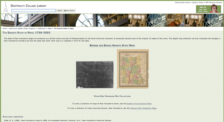
New Hampshire has roots in British colonial history, beginning as part of Massachusetts before it became its own state in 1788. Over the past three centuries or so, explorers and others have seen fit to map the Granite State for purposes political, cultural, and otherwise. This great digital collection from Dartmouth College brings together over 125 maps dating from the early 1770s all the way up...