Drawing on the holdings of the New York Public Library (in particular the Lawrence H. Slaughter Collection), and sponsored by the National Endowment for the Humanities, this online exhibit is devoted to offering a number of historically significant maps of the Mid-Atlantic region up to 1850. The site begins with a brief essay on the nature of the items featured on the site and continues with three...
Documenting "the struggle between Britain and America for the ownership of the region, and the further development of one of the last frontiers on the continent" is one of the primary goals of this digital collection of maps relating the history and development of the area that eventually would become Washington state. Created by a partnership between the University of Washington and Washington...
The passage of the Land Ordinance of 1785 created the rectangular survey system for the mapping and subsequent sale of the western public lands of the United States. In 1803, the first survey of the lands, which would later become the state of Illinois, began. After moving northwards from southern Illinois in 1806, the federal surveyors finished surveying the last townships in 1843, but for four...
The James Ford Bell Library at the University of Minnesota provides the Historical Maps page as part of their main Web site. Users can view more than fifty maps online, each of which contain a short description of what the map is depicting. One example is a navigational map of Africa and the Atlantic and Indian Oceans that was designed to illustrate the first Dutch expedition to Java undertaken by...
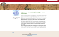
The Pimeria was a region (never defined with any exacting detail) of Spanish colonial Mexico that encompassed what is now southern Arizona and northern Sonora. Derived from the Pima Indians who live in the region, the name first appeared on a map prepared in 1696. This online collection consists of over thirty separate maps, ranging in date from 1556 to 1854. Each map features detailed cataloging...