The Norman B. Leventhal Map Center at the Boston Public Library boasts an impressive collection of American Revolutionary War Era Maps. All told, there are nearly 2,000 hand-drawn maps currently available in the Portal, all produced between the years 1750 and 1800. Locations mapped include Boston, wider New England, the rest of Eastern North America, and the West Indies. The collection, which has...
Drawing on the holdings of the New York Public Library (in particular the Lawrence H. Slaughter Collection), and sponsored by the National Endowment for the Humanities, this online exhibit is devoted to offering a number of historically significant maps of the Mid-Atlantic region up to 1850. The site begins with a brief essay on the nature of the items featured on the site and continues with three...
Provided by the History Department of the United States Military Academy (West Point), this site offers an extensive collection (over 400) of color maps originally produced for a course entitled History of the Military Art. The atlases cover international and civil conflicts from American colonial campaigns to Somalia in 1992-93. The maps are browsed by war/ conflict and are presented as large...
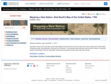
What did explorers and others know of the United States in 1784? It's a fine question and one that has fascinated historians, geographers, and others for decades. This gem of an online exhibit looks at a map created in March of 1784 by Connecticut engraver, Abel Buell. It is in fact the very first map of the newly independent United States compiled, printed, and published in America by an...
Jean Baptiste Donatien de Vimeur, comte de Rochambeau was the commander in chief of the French expeditionary army from 1780 to 1782. Rochambeau played a key role in the American Revolution, and his extensive map collection covered a great deal of eastern North America. The American Memory project at the Library of Congress has taken 40 manuscript and 26 printed maps from Rochambeau's collection...