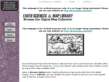
Presented by the University of California Berkeley's (UCB) Earth Sciences and Map Library, the Browse Our Digital Map Collection Web site lets visitors do just that. Several thousand scanned maps from the collection are available and can be searched via the UCB Library Pathfinder program. After orientating oneself to the peculiarities of the search program, which seems more daunting than it...
The California Department of Water Resources's Division of Flood Management provides this series of real-time maps representing rainfall over California and Western Nevada. The color, .gif maps, available as either large-scale or detailed regional maps, show one-hour, six-hour, or twenty-four-hour rain gage readings (in inches).
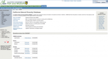
What is the goal of the California Natural Diversity Database? Simply put, it is "a program that inventories the status and locations of rare plants and animals in California." On its page, visitors can look over a remarkable database of GIS-mapped locations, along with key facts about the database, a host of white papers, and information about its vegetation, classification, and mapping program....
Those persons with an interest in the history and government of the Golden State will love the California State Archives, which were originally chartered to receive "…all public records, registered maps, books, papers, rolls, documents and other writings…which appertain to or are in any way connected with the political history and past administration of the government of California." On the...
In a state where water has been a serious public policy issue for many decades, creating an atlas of water resources and usage was considered an important undertaking. That's just what happened in 1979 when the state of California released this groundbreaking atlas. After its release that year, it was hailed as a major achievement in cartography and scientific endeavor from a variety of groups and...
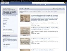
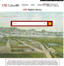
The UCLA Library has a range of digital collections that document every aspect of Golden State history. Of course, any good Angeleno or anyone else with an interest in the state will appreciate this collection of 84 maps of Los Angeles, the United States, and of course, other locales. Visitors can browse the entire collection by language, name, subject, or area of geographic coverage. A great...
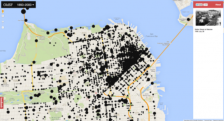
What did the Sunset neighborhood of San Francisco look like in 1904? Now you can find out with this wonderful geotagged map of San Francisco. Through geocoding, photos from the San Francisco Public Library's Historical Photograph Collection were associated with latitudes and longitudes to link up photos to their various locales within the city. Visitors can zoom in and out of the map to explore...
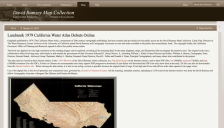
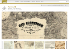
Visiting an airport can be a stressful endeavor, so it's always nice to have a few distractions. There's a rather fabulous one at the San Francisco International Airport (SFO), currently, and it comes in the form of historic maps. Culled from the David Rumsey Map Collection, this in situ exhibit contains dozens of maps that document the city's development. On this site, visitors can view maps of...
Since the Scout Report last visited the Digital Map Collection at the University of California, there have been many worthy additions to this cartographic cornucopia. The maps are both historic and contemporary, and they include zoning maps, land use maps, historic maps of the state's coastline, and so on. Visitors can elect to browse all of the California digital maps, or the non-California...
Developed as part of President Franklin D. Roosevelt's massive package of assistance programs designed to pull the United States out of the Great Depression, the Works Progress Administration (WPA) was known for employing thousands of artists to paint murals in federal buildings and for also employing thousands of the nations' unemployed in hundreds of massive construction projects around the...