Brooklyn Revealed
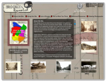
Brooklyn is the most populated borough in New York City, but it wasn’t always so. Settled by a mix of Dutch and English colonists in the mid 1600s, what we now call Brooklyn was once divided into six independent towns. Gradually, the towns merged to form the city of Brooklyn, which was the third largest city in the United States until it became a borough of the Greater City of New York in 1898. To begin exploring this site, crafted by the New York Historical Society, click the Interactive Map. Drag your mouse over the original six towns of Bushwick, Brooklyn, Flatbush, Flatlands, Gravesend, and New Utrecht for brief histories of each, or click on the towns to view dozens of photographs and explanations from different periods of their development. Fascinating stories of how the streets of Brooklyn got their names can also be found here.
Archived Scout Publication URL
Scout Publication
Publisher
Classification
GEM Subject
Required Software
Language
Date of Scout Publication
September 19th, 2014
Resource URL Clicks
188
Internal
Cumulative Rating
0
Comments