Atlases, Maps and Park Plans of Cleveland and Cuyahoga County
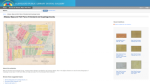
For visitors with an interest in urbanology, city planning, and the growth and transformation of the Cleveland region, this trove from the Cleveland Public Library is quite a find. It contains over 110 maps, plans, and aerial photos that document the urban area from the early 20th century to the present day. On the homepage, visitors can learn more about the collection and view sample images, such as proposed design plans for new residential subdivisions and planned park improvements. Under the Browse these suggested topics area, visitors will find Sanborn Insurance maps, elaborate aerial photographs of Cuyahoga County from the 1950s, and much more. First-time visitors should look over the fascinating Centennial map of Cleveland, its railroad and park systems, 1895-6, which documents the extensive network of railroads that circled the city at that particular historical moment.
Archived Scout Publication URL
Scout Publication
Publisher
Language
Date of Scout Publication
August 15th, 2014
Resource URL Clicks
57
Internal
Cumulative Rating
0
Comments