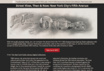
Street View, Then & Now: New York's Fifth Avenue
This entertaining and educational site from the New York Public Library allows readers to explore Manhattan's Fifth Avenue using both photographs from 1911 and paired images from the current iteration of Google Maps. Readers may use the directives "go south," "go north," and "cross the street" to move through the parallel landscapes. The results are hypnotizing. In the opening image, the New York Public Library rests on a treeless street free of cars in the 1911 version, while it is dwarfed by large buildings in the 2015 image. Other images showcase horses and carriages juxtaposed with delivery trucks and taxis. Readers will notice the copious sense of space that the streets possess in the early 20th century images, compared with the trafficked busyness of the contemporary images, among other more subtle differences. Readers may also opt to open the images in the NYPL's Digital Collections, where the vivid photographs are accompanied by detailed information and may be downloaded for free.
Archived Scout Publication URL
Scout Publication
Creator
Publisher
Classification
GEM Subject
Language
Date of Scout Publication
March 4th, 2016
Resource URL Clicks
186
Resources


Comments