Through their interactive website and educational outreach efforts, NASA’s Goddard Institute for Space Studies brings many of their research findings to the general public. In this particular learning module, educators and students will get the chance to learn about how a planet’s climate is determined. The primary aim of the module is “for students to develop a scientific view that our...
Created by the folks at the Science Education Resource Center (SERC) at Carleton College, the Earth Exploration Toolbook (EET) was created "to support access to and effective use of scientific datasets and analysis tools by the educational community." The chapters of the Toolbook provide educators step-by-step instructions for using Earth system science datasets and scientific analysis tools....
What goes on during an earthquake? Who came up with the theory of plate tectonics? What can the fossil record tell us about the evolution of life on Earth? These are all fine questions, and students and educators with a thirst for geological knowledge will find the answers to these (and many more) questions in the "Earth Revealed" television series. Offered as part of the Annenberg Media website,...
Administered by the Universities Space Research Association, this website features a new fantastic image, picture, graphic, or artwork everyday dealing with an aspect of earth science. Visitors can find information about the featured phenomenon in the caption and from provided links. Archives dating back to September 2000 include images of Hurricane Andrew, Typhoon Bilis, Aorounga Impact Crater,...
Earth Science System Data (ESSD) is a free, online, peer reviewed journal that publishes original data sets for other members of the scientific community to use. Edited by and for scientists around the globe, ESSD endeavors to, "make data sets a reliable resource to build upon and to reward the authors by establishing priority and recognition through the impact of their articles." Thus, ESSD hopes...
Teachers looking for materials to help out in the classroom will find this well-organized site most useful. Created by the folks at Geology.com, the site's materials were compiled by Christy Pratt, and they are organized into nine thematic areas. These areas include "Volcanoes", "Water", "Weather", "Erosion", and "Plate Tectonics". The resources featured within each section are taken from...
The American Geological Institute organizes Earth Science Week (ESW) each year in October "to help the public gain a better understanding and appreciation for the Earth Sciences and to encourage stewardship of the Earth." The website offers highlights, evaluations, and news clippings of past ESW events. During the months leading up to ESW, users can search for Earth Science events taking place in...
The American Geological Institute's Earth Science World website serves as a gateway to the geosciences. Visitors can find climate data for stations throughout the world. Users can search great images of volcanoes, lakes, minerals, dunes, and much more. The site provides a helpful interactive geological time scale. Educators and students can discover activities and themes for future Earth Science...
If you want to go around the world via thousands of visually stimulating and engaging photographs, this is a good place to start. Provided by the American Geological Institute (AGI), the Earth Science World Image bank website contains over 6,000 images related to the geophysical sciences for use by educators, the public, and the geoscience community. The photos are contained within a few dozen...
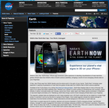
This app from NASA gives readers a peek into the constantly fluctuating elements of the earth’s atmosphere. Using 3D models constructed from satellite images, the app visually displays the causes and effects of climate change via surface air temperature, carbon dioxide and carbon monoxide levels, and sea level height anomalies among others. Fascinating for students, teachers, and anyone interested...