Seismic Illumination
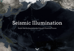
John Neilson of Esri Story Maps has created Seismic Illumination, a project that illustrates what earthquake activity reveals about earth's tectonic plates and the Pacific Ring of Fire. Utilizing earthquake data from the U.S. Geological Survey and satellite images from NASA Visible Earth, Neilson depicts individual earthquakes throughout history as a single illuminated dot. Over time, these dots begin to form an outline viewers will recognize as contemporary continents. These dots also illuminate the Pacific Plate, the largest tectonic plate. In a series of visualizations in this story map, the dates of famous earthquakes along the Pacific Plate are labeled within the map of earthquakes. As a whole, this story map demonstrates how single events like earthquakes can help scientists understand phenomena when viewed in aggregate: "One bit of data, like a pinprick of light, is itself an interesting and useful construct. But individually, and out of context, it is of limited utility and fails to reveal a bigger picture. When these small (in a global sense) seemingly-independent entities are seen from the perspective of vast scales, both geographically and temporally, they begin to take their true form, illuminating the foundational structure to which we would be otherwise blind."
Archived Scout Publication URL
Scout Publication
Creator
Publisher
Classification
GEM Subject
Language
Date of Scout Publication
November 17th, 2017
Resource URL Clicks
191
Comments